
A photograph that could only be made at sunrise, and a field of study that lives by waiting for the light.
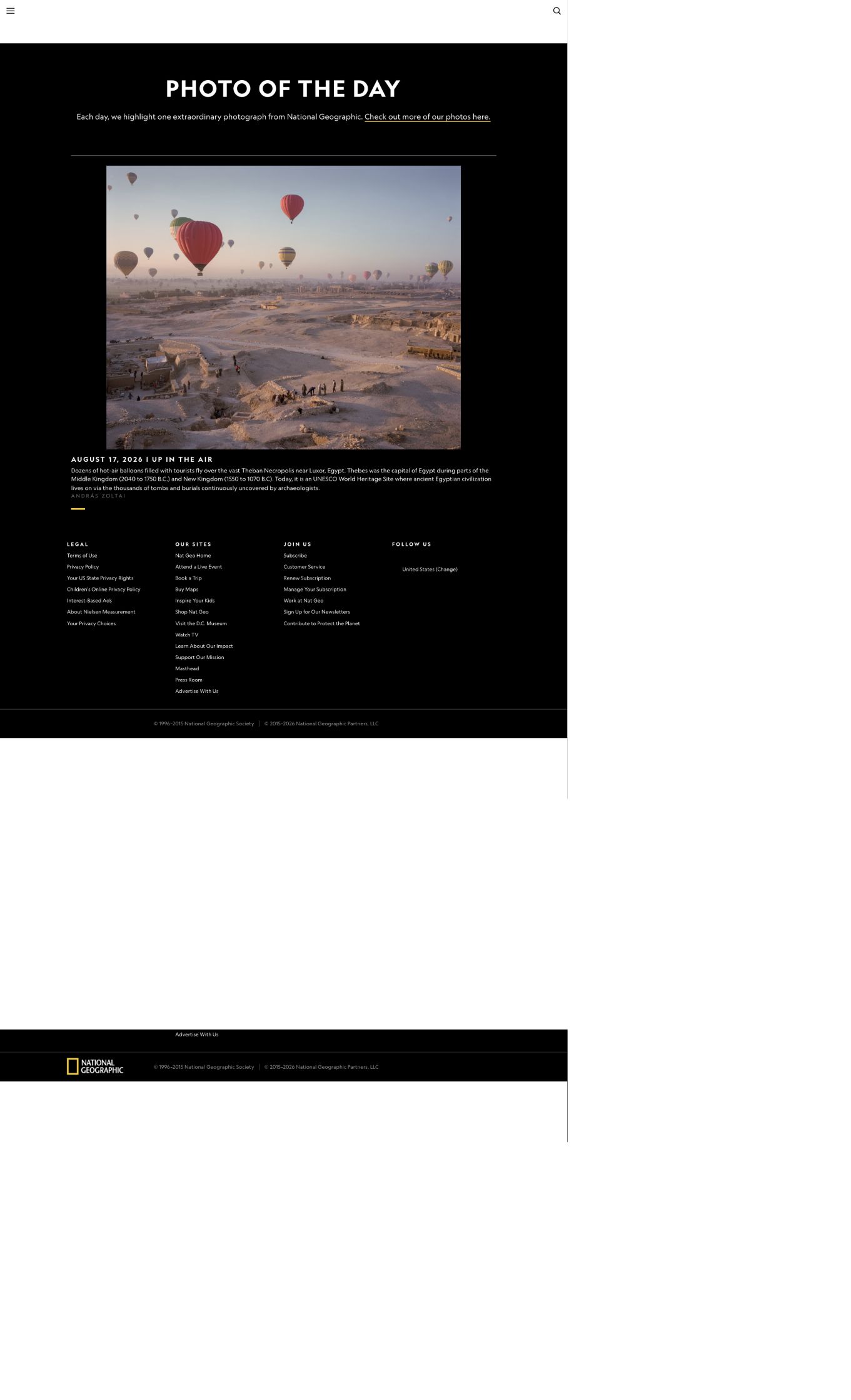
Screenshot: National Geographic Photo of the Day | Photograph: András Zoltai | Original page
Dozens of hot-air balloons carrying tourists drift above the vast Theban Necropolis near Luxor, Egypt. The photograph is titled "Up in the Air," and its maker is Hungarian photographer András Zoltai.
One thing about the image is worth stating at once: it could only have been made during a few dozen minutes of the day. The balloons do not launch whenever they please. The reason for choosing this hour happens to be the same principle by which some of the tombs below have been found.
The Nile's Two Banks Divided the Work for 3,000 Years
Begin on the ground.
Thebes was one of ancient Egypt's capitals. National Geographic's caption gives the relevant periods as parts of the Middle Kingdom, 2040 to 1750 BCE, and the New Kingdom, 1550 to 1070 BCE. The city straddled the Nile, but the division between its banks was stark: the east bank belonged to the living, with the temples of Karnak and Luxor; the west bank belonged to the dead, with the Valley of the Kings, the Valley of the Queens, and thousands of tombs for nobles and artisans.
This was not an administrative plan. It came from looking up. The sun rises in the east and sets in the west every day. In ancient Egyptian geography, the west was where the sun went each evening, so that was where people went too.
UNESCO inscribed "Ancient Thebes with its Necropolis" on the World Heritage List in 1979 under criteria (i), (iii), and (vi). The property covers 7,390.16 hectares, with a further 443.55 hectares in its buffer zone. The necropolis alone extends across roughly 10 square kilometers, containing thousands of tombs, dozens of temples, and the remains of villages, shrines, monasteries, and workshops. At its height, the city may have held about 50,000 people.
The most important phrase in the caption is that tombs and burial pits here are still being uncovered by archaeologists. This is not a site whose excavation is finished. It is still growing.
Why the Balloons Must Fly at Sunrise
Now return to the air.
A hot-air balloon has no rudder. It does not fly against the wind; it becomes part of the wind. The pilot's only real choice is altitude, ascending or descending to find air currents moving in different directions. That makes launch time the most consequential decision of the flight.
Why is morning best? The US Federal Aviation Administration's Balloon Flying Handbook gives two relevant reasons.
The first is a temperature inversion. The handbook says low-level inversions are usually of greatest concern to balloon pilots, and that they dissipate during the day as sunlight mixes the air. Overnight, the ground loses heat by radiation, cooling the air next to it below the temperature of the air above. The result is a lid that suppresses vertical motion and keeps the wind light and steady. As the sun climbs, the ground warms, the lid breaks, and thermals begin to rise. The handbook specifically warns that in very dry air, convective currents may already exist even when no cumulus cloud is visible. A balloon will begin to jolt.
The second reason is buoyancy itself. The handbook notes that atmospheric pressure, temperature, and air density vary with altitude, directly affecting balloon performance, especially useful load and burner performance. The principle is simple: a balloon flies because the air inside it is lighter than the air outside. The cooler and denser the surrounding air, the more lift the same internal temperature can produce. That cool morning air can make the difference of one more passenger.
Those dozens of balloons sharing the sky are not there by romantic arrangement. They are inside the day's one useful window, when the wind is lightest, the air steadiest, and the lifting capacity greatest.
Archaeologists Wait for the Same Light
Sunrise is just as valuable to another group on the ground, for an entirely different reason.
Archaeology has a concept called shadow marks. When sunlight skims the ground at a very low angle, rises and depressions only centimeters high can throw long shadows. From the air, the outlines of ancient wall foundations, ditches, roads, and mounds suddenly emerge. At ground level, or under the overhead light of noon, they may be invisible.
Aerial archaeology therefore has its golden hours: early morning and evening, when the sun is lowest. Winter is often the best season because vegetation is sparse and the light arrives at a lower angle. The complex defenses of Maiden Castle in Britain have been read from the air this way. In China, researchers have also used synthetic-aperture radar imagery to detect shadow patterns cast by ancient city walls beneath farmland.
That gives the photograph its double meaning. The balloons occupy the few minutes when the ground is most willing to speak. They need the air not to buck; archaeologists need the surface to become legible. Two different tasks happen to require the same light.
Beneath the Balloons, a Village Was Moved
Look one layer farther down. People once lived where the balloons' shadows now pass.
On a hillside in the necropolis stood the village of Sheikh Abd el-Qurna. Its residents lived in circumstances perhaps found nowhere else: their houses were built over ancient tombs, and some incorporated tomb chambers directly into their homes. Villagers began moving into the hillside's rock-cut spaces in the early 19th century. When the English traveler Edward William Lane recorded the place in 1825, the old village was already empty.
The decisive change came in the mid-20th century. Between 1946 and 1952, the Egyptian architect Hassan Fathy was commissioned to design and build New Gourna, a low-cost village made with traditional materials and passive-cooling methods, so that residents could be moved away from the tombs. The villagers strongly resisted the relocation. Today, only the mosque, the market, and a few houses remain of the settlement once repeatedly celebrated by the architectural world.
The photographer, András Zoltai, was born in Szentes, Hungary, in 1990 and works in Budapest as a documentary photographer. A National Geographic Explorer and three-time recipient of the József Pécsi Photography Scholarship, he received the Hemző Károly Award in 2025. His long-running project Blue Memoir is about water in Hungary.
A photographer of water made this image in one of the driest places on Earth, where 3,000-year-old remains have survived precisely because it almost never rains.
Sources
National Geographic Photo of the Day caption, August 17, 2026; UNESCO World Heritage property 87, "Ancient Thebes with its Necropolis"; US Federal Aviation Administration, Balloon Flying Handbook (FAA-H-8083-11B), chapter 4; Wikipedia entries on shadow marks and Qurna; and the photographer's website.