
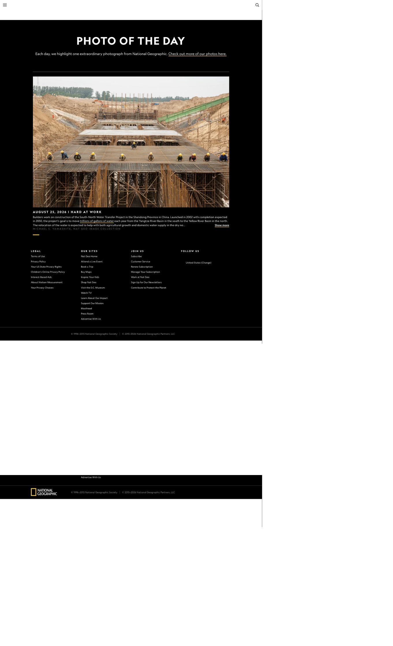
National Geographic's Photo of the Day was made in China, and it contains a contrast that many people in China have never heard.
Screenshot: National Geographic Photo of the Day · Original page
Today's title is only two words: "Hard at Work."
The official image description shows several people in hard hats standing atop an outdoor structure made of pipes. It identifies a construction site for the South-to-North Water Diversion Project in Shandong Province, China. Begun in 2002 and historically planned for completion in 2050, the project is intended to move trillions of gallons of water each year from the southern Yangtze basin toward the northern Yellow River basin.
The photographer is Michael S. Yamashita, a Japanese American who began working for National Geographic in 1979. Much of his work since then has focused on Asia: Marco Polo's route, Zheng He's voyages, the Great Wall, the Tea Horse Road, the Mekong and China's Grand Canal.
One detail in the photograph comes first: it was made in Shandong.
Shandong Means the Eastern Route
The project is not one canal but three.
The Middle Route begins at the Taocha canal head of the Danjiangkou Reservoir and runs north to Beijing and Tianjin. The Eastern Route begins at the Jiangdu Water Conservancy Hub on the Yangtze, follows the Beijing-Hangzhou Grand Canal north and crosses Jiangsu and Shandong. The Western Route has not begun construction.
Only the Eastern Route passes through Shandong, and it is the route on which water must be lifted uphill.
The description says the people stand on an outdoor structure of several pipes. That closely matches the Eastern Route's most conspicuous feature: rows of large-diameter pressurized outlet pipes at its cascade pumping stations. This is an inference from established facts, not an identification stated in the caption. Because the photograph itself was unavailable for inspection, no claim is made here about the exact number of people, weather, light or pipe diameter.
The picture is also old. The first phase of the Eastern Route began formal operation on November 15, 2013; Shandong no longer had a construction scene of this kind afterward. The photograph is therefore at least thirteen years old.
The caption's 2050 completion date is the long-term horizon in the State Council's December 2002 master plan. No official document found from 2025 or 2026 restated that year.
The Contrast
The Middle Route: 1,276 Kilometers Without a Pump
The main canal from Taocha to Tuancheng Lake at Beijing's Summer Palace runs 1,276 kilometers, or 1,432 kilometers including the Tianjin branch.
There is not one pump along the way.
Beijing's official South-to-North Water Diversion exhibition explains why: the water level at Taocha is about 100 meters above Tuancheng Lake, allowing gravity flow throughout.
Across 1,276 kilometers, a 100-meter fall averages 1:12,760, or about 7.8 centimeters per kilometer. Across a 20-meter classroom, that would be 1.6 millimeters, less than the 1.9-millimeter thickness of a one-yuan coin standing on edge. Across a 25-meter pool, it would be less than 2 millimeters.
Engineers had to maintain that fall across the full distance. The canal follows the natural elevation band along the eastern foot of the Taihang Mountains. It does not cross the mountains; it hugs them. The route has 27 large aqueducts and 102 inverted siphons, with a design discharge of 350 cubic meters per second and an increased discharge of 420.
Two qualifications matter. The official figure is only "about 100 meters"; exact official elevations for both endpoints were not verified. Canal-bed gradients vary by section, and much of that head is consumed by losses at control gates, aqueducts and siphons. The 1:12,760 figure is an average, not the designed bed slope.
The Eastern Route: 34 Pumps, 65 Meters Up
Xinhua explains the problem plainly: some northern areas on the Eastern Route stand above the source. Water must be pumped northward uphill until it crosses the high point and can again flow by gravity.
The first phase begins at Jiangdu and has 13 pumping stages, 22 hubs and 34 pumping stations, providing 65 meters of lift. Zaohé No. 1 has a design flow of 200 cubic meters per second and is Asia's largest pumping project by flow per unit. The trunk route runs roughly 1,150 kilometers, much of it through existing channels of the Beijing-Hangzhou Grand Canal.
This is the route the workers in the photograph were building.
The Middle Route found an almost invisible downhill path. The Eastern Route had none, so 34 pumps lift Yangtze water up a 65-meter staircase. The same water moves north by opposite physics.
One River Passes Beneath Another
At Xingyang, Henan, the Middle Route meets the Yellow River. The solution was to go under it.
The Yellow River Crossing Project consists of two parallel tunnels, each 4,250 meters long: 800 meters beneath Mangshan and 3,450 through the river section. Each has an inner diameter of 7 meters and an outer diameter of 8.7 meters. At its deepest, it lies 40 meters below the riverbed.
A 1,600-ton slurry-pressure-balance shield machine carried more than 140 cutters on its head. Fourteen groups of jacks supplied a total thrust of 6,034 tons. Every 1.6 meters, excavation stopped while one ring of 40-centimeter-thick segments was installed. Progress averaged more than ten meters a day. The upstream tunnel broke through at 10:28 a.m. on June 22, 2010.
Guangming Daily described it neatly: Yangtze water does not intrude on Yellow River water, nor the Yellow on the Yangtze. The two form a three-dimensional cross and continue separately.
An artificial river passes beneath a natural one, and neither knows the other is there.
How Much Water Has Moved?
On August 10, 2026, Xinhua reported figures from the Ministry of Water Resources and China South-to-North Water Diversion Group: the first phases of the Eastern and Middle routes had transferred more than 90 billion cubic meters. The Middle Route accounted for more than 80.05 billion and the Eastern Route more than 9.95 billion.
The system serves 48 large and medium-sized cities and supplies water to 195 million people across Beijing, Tianjin, Hebei, Henan, Shandong, Jiangsu and Anhui. Urban domestic-water reliability on the Middle Route rose from 75 percent to above 95 percent; domestic and industrial reliability on the Eastern Route rose from 80 percent to above 97 percent. Middle Route water has remained at surface-water Class II or better and Eastern Route water at Class III.
The total had been 88 billion in May. A rise of 2 billion cubic meters in three months averages roughly 22 million cubic meters a day.
For Beijing residents, the direct figure is this: more than 80 percent of domestic water in central Beijing comes from the project, while central Tianjin receives almost 100 percent. Turn on a Beijing tap and that water has probably traveled 1,276 kilometers.
To protect Class II quality, the automated station at Taocha tests 197 indicators with sensitivity at the nanogram scale, a billionth of a gram.
Now for the Other Half
The North China Plain once contained one of the world's largest groundwater depression cones. Beijing's average groundwater depth fell from 15 meters in 2000 to 26 meters in 2014, an eleven-meter decline in fourteen years.
After the transfer began, levels recovered. Official figures report a rise of 3.76 meters in shallow groundwater and 7.65 meters in deep groundwater. Baiyangdian improved from worse than Class V to Class III. The Yongding and Hutuo, dry for years, carried water again. Nansi Lake lost its "soy-sauce lake" condition, and the Grand Canal has flowed end to end for five consecutive years.
How much credit belongs to the diversion?
A 2020 Nature Communications study separated Beijing's groundwater recovery from 2006 to 2018. Imported water reduced the cumulative groundwater deficit by about 3.6 cubic kilometers, or 40 percent of total recovery. Increased precipitation contributed about 2.7 cubic kilometers, or 30 percent; policies reducing irrigation contributed 2.8 cubic kilometers, also 30 percent.
Four parts came from the canal, three from extra rain and three from using less irrigation water. The 1,400-kilometer channel was only one of three answers.
The result supports both sides of the debate. The project worked and provided the largest single contribution. Critics are also right that transferred water treats a symptom and conservation addresses the cause: reduced irrigation already had an effect on the same scale as the entire canal.
The published groundwater-rise figures do not specify their comparison year and should be read against Ministry of Water Resources bulletins. Baiyangdian's recovery also reflects Yellow River transfers and releases from upstream reservoirs.
Other People Were Also Hard at Work
The photograph's title refers to builders. Another group worked just as hard: people displaced by Danjiangkou Reservoir.
The first resettlement accompanied the original dam from the 1950s through the 1970s. Impoundment began in August 1960. Flooded land included Xichuan's fertile Shunyangchuan, Danyangchuan and Banqiaochuan valleys, totaling 548,400 mu, as well as one county seat and more than ten market towns. More than 200,000 people left Xichuan County alone.
The second occurred from 2009 to 2011, when the dam was raised for the Middle Route. Crest elevation rose from 162 to 176.6 meters, normal pool level from 157 to 170 meters, and capacity from 17.45 to 29.05 billion cubic meters.
Depending on the counting method, 330,000 to 345,000 people moved: about 182,000 in Hubei and 150,000 in Henan, including 162,000 moved out of Xichuan. The difference chiefly reflects whether nearby resettlement within a county is included. Across both dam projects, nearly 700,000 people left the Danjiangkou area.
Life after relocation was not uniformly easy. Reporting in 2010 found that some households had little compensation left after buying government-provided homes, enough for only a small plot, while jobs were scarce and some people had to migrate for work. That is criticism from the project's early phase, not a recent assessment, but it records a real moment.
The costs continue. The whole of Xichuan County lies within the Danjiangkou watershed. No verified primary figures were available for closed businesses or retired farmland, so none are supplied. Two facts are enough: an entire county sits inside a source-water protection area, and a canal-head station measures 197 indicators down to nanograms. What Xichuan gave up so that Beijing taps could deliver Class II water is present in those two sentences.
Compared with the World
California's State Water Project has more than 1,100 kilometers of main aqueduct, delivers about 3 billion cubic meters in an average year and serves 27 million people. Its Edmonston Pumping Plant lifts water 587 meters in one stage, the world's highest single-stage water lift. One California station climbs 587 meters; 34 Eastern Route stations together climb 65. California fights vertically, while the Eastern Route runs horizontally.
Libya's Great Man-Made River uses 2,820 kilometers of underground pipe to deliver 6.5 million cubic meters a day. It pumps fossil water left from the ice age, water that is not being replenished and may be exhausted in sixty to one hundred years. Libya is making a withdrawal; the Chinese project is making a transfer. Yangtze water returns as rain. Fossil water does not.
India's Interlinking of Rivers program proposes a much larger transfer, about 210 billion cubic meters, through 14 Himalayan links, 16 peninsular links and 37 intrastate projects. Most remain on paper.
China's distinction is not the scale of its idea but that it built it.
The principal criticisms are evaporation from open channels; ecological damage in the source region; and the possibility that low Yangtze flows in dry years could impair navigation and worsen saltwater intrusion at the estuary. After an extreme drought, a chief engineer at the China Institute of Water Resources and Hydropower Research publicly urged revision of hydrological records and reassessment of drought frequency, because those estimates directly shape the operation and scale of major projects.
A Footnote Dated Today
On August 25, 2026, the day this picture became Photo of the Day, a draft revision of China's Water Law received its second reading.
It proposed a water-pricing mechanism aligned with development, water availability, supply costs, users' ability to pay and conservation requirements. It brought collected rainwater, seawater and desalinated water, mine water and brackish water into unified allocation, with recycled water preferred for urban landscaping. It also placed responsibility on the State Council's water authority to define national groundwater-overdraft zones and their no-extraction and restricted-extraction areas.
A canal can deliver 90 billion cubic meters. Whether that water is enough depends on prices, conservation and whether someone drills the well that should never be drilled.
Construction Continues
The Yangtze-to-Han River Diversion, the first follow-up project, began on July 7, 2022 and entered main-tunnel construction on February 18, 2023.
It draws water at Longtan Creek, 7.5 kilometers upstream from the Three Gorges Reservoir, and sends it through a 194.8-kilometer conduit, including 194.3 kilometers of tunnel, to the Han River's right bank about five kilometers below Danjiangkou Dam.
Once complete, the Middle Route's annual transfer capacity will rise from 9.5 to 11.51 billion cubic meters. The scheduled construction period is nine years. It is, in effect, a new upstream pipe attached to the tap feeding the gravity canal: the Yangtze replenishing the Han.
The Western Route, which would move upper Yangtze water into the Yellow River, still has not begun according to public information. Its Tibetan Plateau setting brings high elevations, complex geology and strong earthquakes; it would require dams roughly 200 meters tall and tunnels more than 100 kilometers long. It remains under preliminary study. No current claim about a start or completion date has a basis.
Sources
National Geographic Photo of the Day; Xinhua, August 10, 2026, and May 24, 2021; Science and Technology Daily, August 11, 2026; People's Daily, May 17, 2026; China News Service, May 10 and August 25, 2026; the Cyberspace Administration of China, "Water Brings Development"; Guangming Daily, June 29, 2010; the Chinese government website, February 18, 2023; Beijing's online South-to-North Water Diversion exhibition; Long et al., Nature Communications (2020); and AsAmNews, July 18, 2022.